


Marine Forecasts for
better navigation

Visual Wind Maps
View a visual wind map overlaid on your digital savvy charts™ to easily see the changing direction and strength of the wind. Toggle through the date timeline to see how the wind will vary over the coming days.


Marine Weather Forecasts
Toggle through various dates and times to see the predicted weather forecast. By dropping a pin on your savvy chart™ you can see the weather prediction for that specific location including wind direction and speed, conditions and temperature.

Nautical Weather Routing
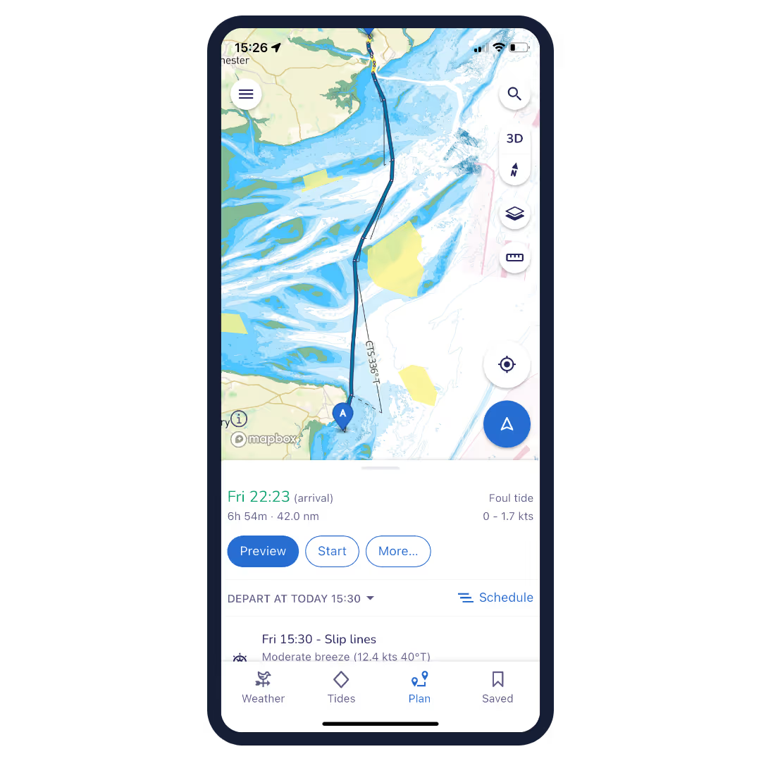
Routes planned with savvy navvy don’t just use chart detail to create your route, they also take weather forecasts, tidal data and your boat settings into account when creating your passage plan, so your route is customised to you and your boat.


Tidal Data
Follow the changing effects of the tide with savvy navvy’s tidal graph and tidal stream overlays. Routes plotting takes into account tidal data, to makes your ETA more accurate. In addition, you can use the tidal graph to review tidal data from over eight thousand tidal stations worldwide and/or view tidal streams over your chart by turning on the tide icon.

Departure Scheduler
How will the changing weather affect your route? Use the our departure schedule feature to evaluate the effect on your route depending on the time you leave. Select the route you like best and the savvy algorithm will automatically update your journey to that departure time.


Offline charts and weather forecasts
Download chart and weather forecast packs for use when offline. By downloading weather packs you can use the predicted marine weather over the coming days to continue planning routes even when out of range of WiFi and phone signal. When you gain signal again simply update your offline packs to ensure you have the latest details available.
Navigation Tools for Modern Boaters
Estimated Fuel Usage
Always ensure you take plenty of fuel for your trip with savvy navvy’s estimated fuel usage. When you switch to “motorboat” mode, and plot a route, our algorithm will choose the best route whilst also providing an estimate of the fuel you require, based on your boat settings.
Anchorage and Marina Information
Travel like a local with key information on anchorages and marinas such as reviews, facilities, seabed holding, fuel and water docks, restaurants and much more.
Automatic Course to Steer (CTS)
Get an automatically generated course to steer when plotting a route. You can even export your route for use with your marine GPS chart plotter.
Satellite and Night Mode
Switch between night mode to protect your night vision, satellite mode for enhanced details or map mode for when you’re underway. Switch the interfaces to suit your needs, not the other way around.
GPS Mode
See your live GPS location, heading, speed and course over the ground as well as visual distance references to key landmarks around you.
Record Track
Always ensure you can find your way home by recording the track of your journey.

Advanced Navigation for Modern Boaters
Download savvy navvy from your app store today

