It's like Google Maps for boats.
Charts, weather, tides... Everything you need in one place.

Over 2 Million Downloads

4.6 out of 5
Over 5,000 5 Star Reviews

RAD NAV APP
I use Savvy Navvy daily for all my inshore fishing here in south Texas. Great for current conditions, including tides and wind direction. It’s like Google maps for boaters. Plan routes, mark your fishing spots and return to the dock in one piece. Every time! Great App 5 stars.

Lifesaver!
2 weeks ago during the heatwave, we were on the Solent and the temperature fried all our instruments including the GPS plotter. Thank god we had Savvy Navvy as it worked perfectly for the entire weekend and allowed us to do everything we wanted. People say these kind of apps aren’t meant to replace the instruments on board, well I can confirm that when they instruments on board all fail, this was an absolute lifesaver. Can’t wait to test it in other countries.

Great and simple to use
I sail with friends and families and this app is a great way to illustrate “dads” boring chart work through a much more teenage friendly platform. I use both for cross reference and find it pretty accurate. Considering the price of charts it is extremely good value.
Game-Changing Innovation
to Boost Your Navigation


Digital Savvy Charts™
View clean and easy to use nautical charts on your phone, tablet or computer. We source data from hydrographic offices around the world and design the chart interface to be user-friendly. Savvy members get access to all our chart data, wherever we have coverage. View our chart coverage.

Arrival Planning - ETAs
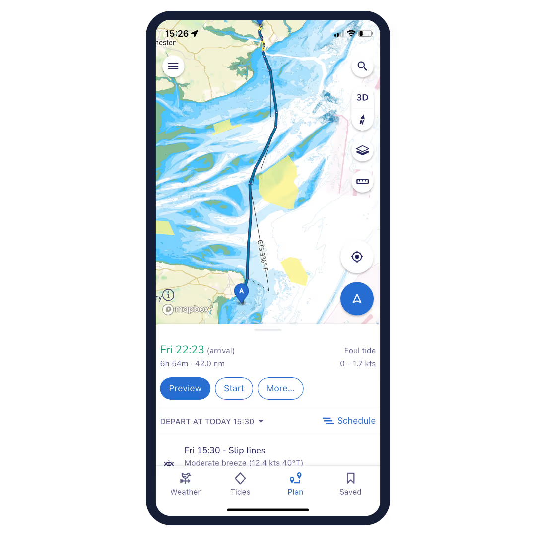
Never miss a reservation or important deadline again with automatically generated estimated arrival times. With our motorboat route planner, you can quickly get an estimated distance, fuel requirement and time of arrival that takes into account weather forecasts, tide data, chart details and boat settings. Share your route with friends to let them know when you’ll be arriving.


Over the Horizon AIS (OHA)
Enhance safety with greater awareness of vessel movements around you. Using your phone’s internet connection we stream vessel data such as speed, distance, MMSI, position, COG and destination.

Nautical GPS
Quick and easy references make your trip hassle-free. Use savvy navvy’s boat GPS positioning mode to instantly see your location, view our savvy marine chart, as well as your course and speed over the ground. savvy navvy is the only navigation app you will need on the water!


Tidal Data
Get instant access to tidal data from eight thousand tidal stations around the globe. savvy navvy’s tidal graph also gives you a quick visual reference for tidal highs and lows throughout the day. Tap the tidal streams toggle to get a visual overlay of tidal strength and direction on your digital marine map (chart).

Marine Weather Forecast
Drop a pin anywhere on your savvy chart™ to review forecasted temperatures, weather conditions and wind strength for that location. Use the weather graph to view the changing effects of the weather forecast throughout the day.


Plan Your Trip
Savvy Navvy has an inbuilt boat route planner. Set the location for your start and finish positions and the savvy routing™ algorithm will calculate the best route based on your boat settings, tide, chart and weather information. Routes can then be shared with friends or exported for use with your chartplotter.

Schedule departure time
See at a glance the best time to depart based on your route, wind & tidal conditions, see the demo.

Explore even more cool features
Automatic CTS
Our routes provide an automatic course to steer with a detailed preview of your route.
Local Facilities - Marinas & Anchorages
Plan the perfect lunchtime pit-stop or overnight stay by exploring detailed marina and anchorage information before you leave. Get detailed information on moorings, restaurants, fuel stations, and more.
Satellite overview
They say it’s all in the detail. So why not take a closer inspection of secluded bays, marinas, anchorages and more by switching to satellite mode for a better look.
Offline Charts and Weather for Motorboats
Life is busy enough, so if you like to wander out of range of WiFi or phone signal, we get it. Before you go off-grid download your chart (or as some call it, a motor boating map) and weather information so you can continue to use all the savvy features you love when offline.
Export Your Route
If you would like to use your Savvy Route with your GPS chartplotter, that’s fine with us! Select “Export route” in the app to download a GPX file which can then be uploaded to the chartplotter of your choice.
We’re Here if You Need Us - Customer Support
With savvy navvy you’re never really boating alone. Our team are on-hand to help answer your questions if and when you need us, simply tap the chat bot in the app and we’ll get right back to you.
Boat navigation made easy
Let’s get started...
The Savvy Navvy boating app is available on Android or iOS with a 14-day free trial.


